
Symbol Mark
The symbol of Gyeongsangnam-do represents the will to building the bright future of Gyeongsangnam-do, like the sun with indomitable spirit of the citizens of Gyeongsangnam-do and its beautiful environment. It also symbolizes the determination of raising Gyeongsangnam-do to an international level.
Geography
Gyeongsangnam-do is located in the southeast region of the Korean peninsula and meets Busan and Ulsan Metropolitan City on its eastern border, and Namhae on its southern border. The northern border of Gyeongsangnam-do faces Dalseong of Daegu Metropolitan City and Cheongdo, Goryeong, Seongju and Gimcheon of Gyeongsangbuk-do. Gyeongsangnam-do borders Muju, Jangsu and Namwon of Jeollabuk-do and Gurye and Gwangyang of Jeollanam-do the west.
Administrative District
Gyeongsangnam-do, with a population of 3,410,002(as of December 31, 2020) consists of 8 Cities, 10 Guns, 5 Gus, and 308 Eups, Myeons, and Dongs.
Latitude, Longitude
Gyeongsangnam-do is located between 34 degrees 29 minutes and 35 degrees 54 minutes north latitude, and between 127 degrees 34 minutes and 129 degrees 13 minutes east longitude. The current area of Gyeongsangnam-do is 10,532.7㎢ and accounts for about 10.5% of the total area of South Korea. It is the fourth largest municipality following Gyeongbuk, Gangwon and Jeonnam. Gyeongsangnam-do has around 400 islands, which include Geoje and Namhae, which account for about 8.5% of the total area of Gyeongsangnam-do.
Climate
Located in the far southeast corner of the Korean peninsula, Gyeongsangnam-do borders the sea to the south. This coastal area influences the province considerably because it is confined by high mountains to the north, which shuts out the cool winter wind from the northwest. This creates the most moderate climates in Korea with 12 to 13℃ annual average temperature, 1,400 to 1,800℃ annual precipitation level and -0.5 and 25.1℃ of mean temperature in January and August respectively. The annual average temperature, the precipitation level and the average temperature of January and August is 14 to 15℃, 1,400 to 1,800℃ and 2.3 and 25.9℃ respectively, along its coastal area.
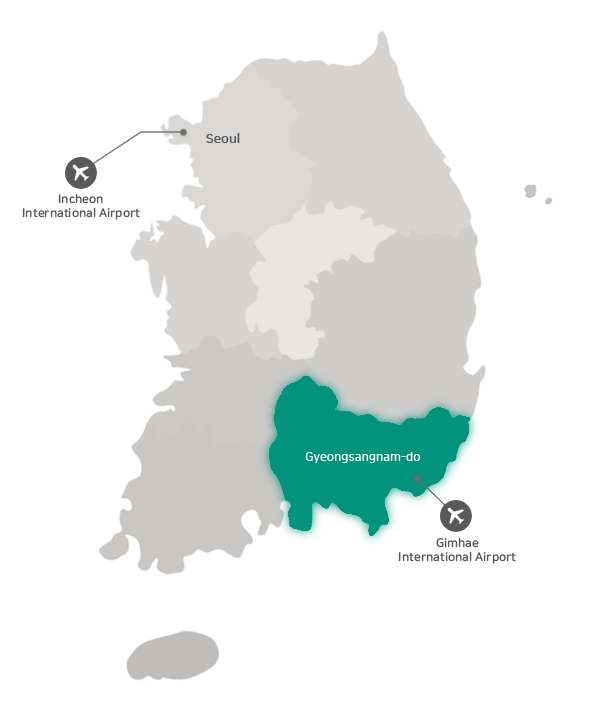
Traffic
Gyeongnam Provincial Government is about 40 minutes drive from Gimhae international airport and 4 hours 40 minutes from Incheon international airport. To get here, you can also take public transport such as bus or train.